The Metropolitan Railway (1863)
The world's first underground railway opens beneath London in 1863. The Metropolitan Railway runs from Paddington to Farringdon. NOTE: This is a topological map based loosely on Beck's 1933 layout. It is not based on any published map, which were typically geographical in nature.The Metropolitan District Railway (1874)
In 1871, the Metropolitan District Railway joins the Metropolitan Railway in running underground train services. NOTE: This is a topological map based loosely on Beck's 1933 layout. It is not based on any published map, which were typically geographical in nature.Closing the Loop (1885)
The two companies' lines are rapidly extending and joining up with existing surface services linking the suburbs. Loops are constructed to make journeys simpler. NOTE: This is a topological map based loosely on Beck's 1933 layout. It is not based on any published map, which were typically geographical in nature.Going Deep (1896)
In 1890, the world's first deep-level underground line (the City and South London Railway) opens. It links Stockwell and King William Street via a tunnel running under the Thames. NOTE: This is a topological map based loosely on Beck's 1933 layout. It is not based on any published map, which were typically geographical in nature.Unified Vision (1908)
The individual companies collaborate more closely and use the "Underground" brand for joint marketing. Geographical maps show colour-coded lines with interchange stations. NOTE: This is a topological map based loosely on Beck's 1933 layout and on the geographical map below.
A Backward Step? (1914)
The different operating companies and third-parties issue maps with varying degrees of usability. Some are printed with a reduced number of colours, presumably to save money. NOTE: This is a topological map based loosely on Beck's 1933 layout and on the geographical map, below, issued by the Underground Electric Railways Company of London.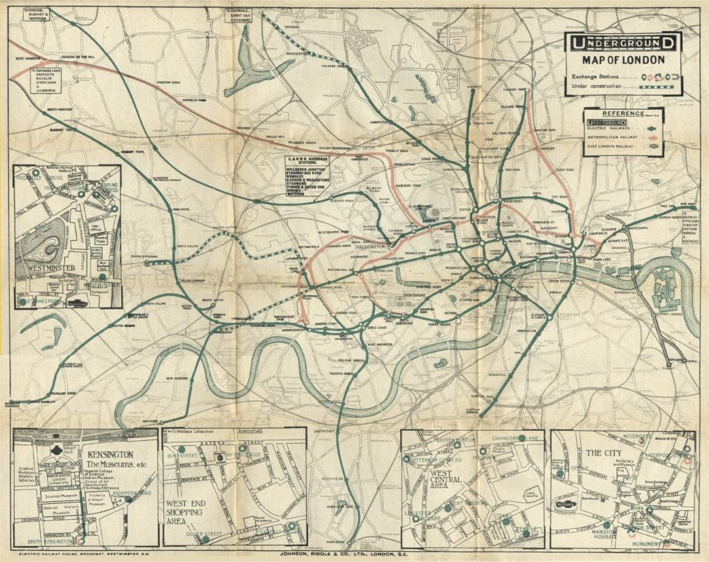
Stingemore's Map (1925)
Between 1925 and 1932, Fred Stingemore designs a series of maps, still mostly based on the geographical relationships between stations. The ghostly outlines of the surface streets are stripped away and the river doesn't make an appearance until 1926. NOTE: This is a topological map based loosely on Beck's 1933 layout and on Stingemore's 1925 map below.
Beck's Map (1933)
The original Harry Beck topological map was published in 1933. The interchange stations are shown as diamonds or squares, depending on the orientation of the line at that point. There are six coloured lines:- District (green)
- Bakerloo (red)
- Piccadilly (blue)
- Central (orange)
- Metropolitan (purple)
- and what was to become the Northern (black).

After World War Two (1945)
In this map, the majority of interchange station labels are duplicated and printed in the colours of the appropriate lines. The central "H" formed by the Watford, Edgware, Wimbledon and Morden lines becomes more pronounced. The Waterloo and City Line is shown linking Bank with Waterloo. Only five colours are used for lines: the Metropolitan and District Lines both now use green.
Introduction of the Circle Line (1951)
The map becomes even more rectilinear with a rather angular Circle Line being introduced. The Central Line is extended east to Epping and Ongar. The Addison Road loop from Earl's Court up to Latimer Road is replaced by the Olympia spur. The general colour scheme has stabilised, if not the precise shades, with all station names printed in black. A few station names, including Earl's Court, acquire apostrophes.
Garbutt's Map (1964)
The map becomes less angular with more use of forty-five-degree angles. It was designed by Paul Garbutt who, like Beck, worked on it in his spare time. The station interchanges have become black and white, with an additional black dot denoting an interchange with British Rail.
Introduction of the Victoria Line (1972)
The Victoria Line opened in 1968. Very little else changed in this version of the map, except for the removal of the Hounslow West branch of the District Line and the treatment of interchange stations.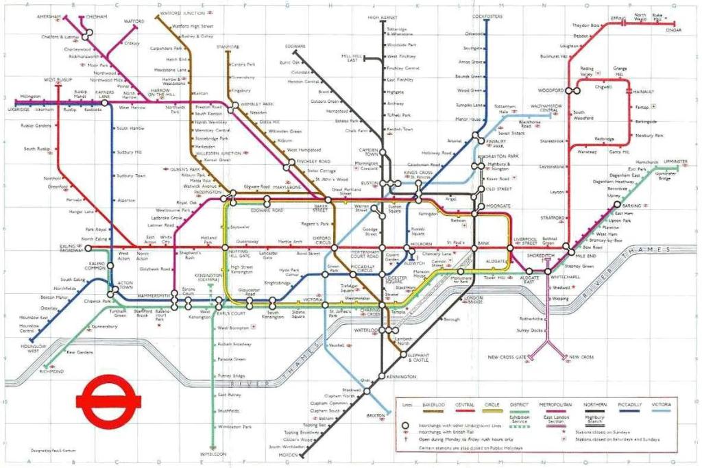
Introduction of the Jubilee Line (1985)
The Jubilee Line to Charing Cross opened in 1979. The angles around Whitechapel are changed. A High Street Kensingston spur of the District Line briefly appears.
Introduction of the Hammersmith & City Line (1994)
Hammersmith & City Line has been split off from the Metropolitan Line. The East London Line is recoloured orange. A kink is introduced to the Central Line to bring Bank and Monument stations closer together.
Extension of the Jubilee Line (2004)
The Jubilee Line extension to Stratford via Canary Wharf opened in 1999; passenger services no longer visit Charing Cross. The Bakerloo Line now passes south of the District Line Edgware Road station, resulting in a split of the Paddington interchanges. The river Thames loses its stripes.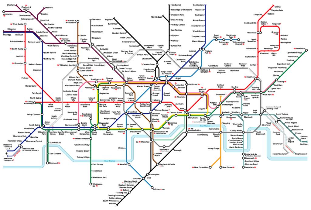
Splitting of the Circle Line (2012)
The Circle Line is no longer circular; it's now a spiral from Edgware Road to Hammersmith. The extended East London Line is now considered part of the Overground network. The Bakerloo Line returns to its original route north of the District Line Edgware Road station. The Heathrow Terminal 5 extension to the Piccadilly Line opens.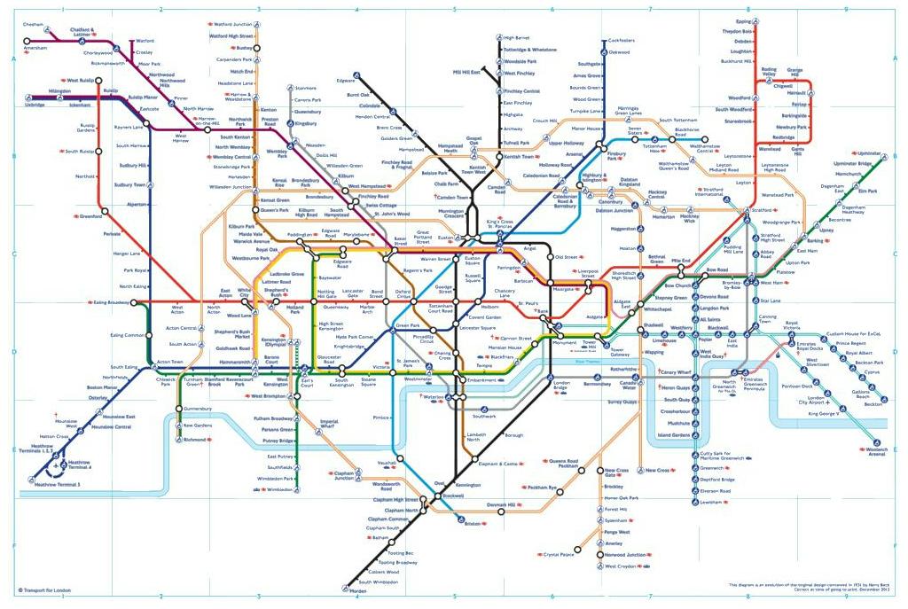
Reproduced with kind permission.More information.